Categories
Local Travel

Bike Overnights: Sooke Potholes

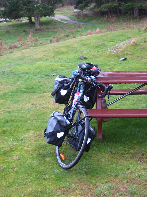
The CRD-owned, T’Souke (Sooke) First Nation-operated Sooke Potholes Campground is our new favourite bike camping site, especially because we’re lucky enough to live right next to the Galloping Goose Trail and can ride all the way out to Potholes without any navigation or traffic concerns at all!

Getting There

Switch Bridge Junction to Sooke Potholes Campground. Click for larger.

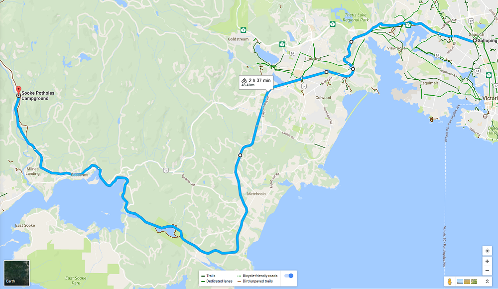
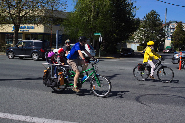
Potholes Campground is gloriously easy to get to – just get on the Galloping Goose or Lochside Trail and head west! No navigation concerns, no vehicle traffic except at road crossings. Kid and nervous cyclist friendly to a fault, barring the distance.

The map above has the trip starting from the Switch Bridge Junction where the Goose and Lochside Trails meet, right by Uptown Mall. Here’s a link to the actual Google Maps setup.

Note that Google Maps will try to route you through central Langford and onto Sooke Road (Hwy 14) by default. I do not recommend following these routing suggestions, unless you want to detour into Langford to get groceries, alcohol, or other last-minute shopping. Stay on the Goose trail the whole way for maximum ride comfort!

Speaking of shopping, Langford’s Westshore Town Centre mall is immediately off the Goose where the trail crosses Kelly Road/Veteran’s Memorial Parkway intersection; there’s groceries, a liquor store, coffee, bank machines, and a pharmacy all there if you realize you’ve forgotten something en route or need a refreshment break. There’s other options further out in Metchosin and Sooke, but Westshore Town Centre Mall is the last shopping centre directly off the trail.

The Goose is entirely gravel past Langford but generally in excellent shape, easy to ride on.

Camping There

The Campground proper is directly off the Galloping Goose Trail; there’s a short side trail (signposted) that drops directly into the top part of the campground from the trail.

Sooke Potholes Campground (Spring Salmon Place Campground) campground map. The trail entry and group site are at image centre at the yellow dot. Map courtesy CRD.

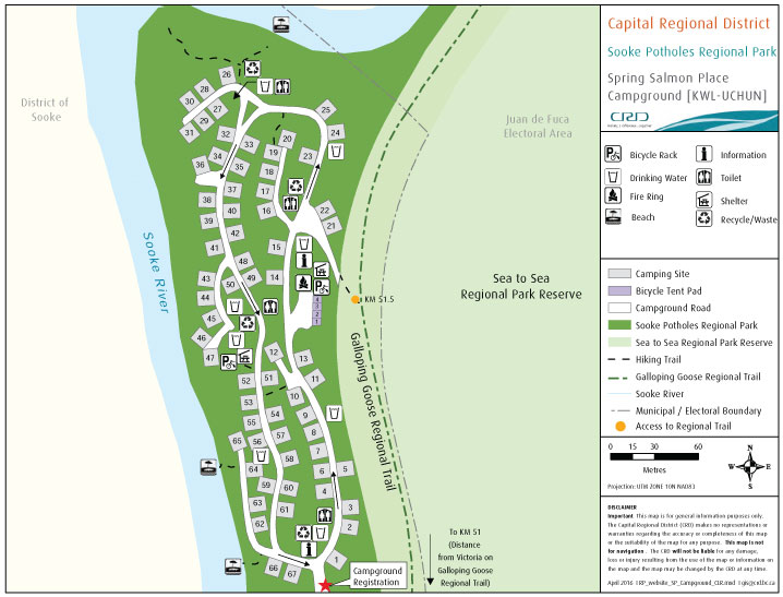
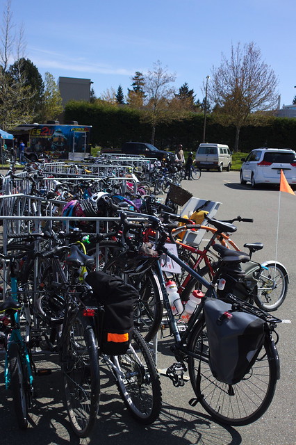
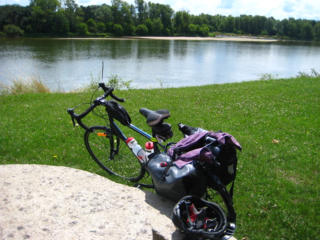
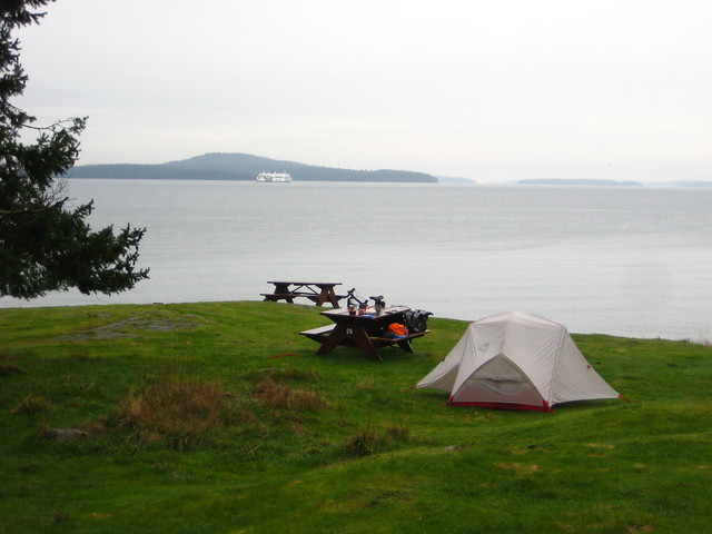
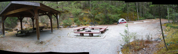
Hiker and biker campers are welcome to use any of the regular campsites, but there is also the car-free group spot set up specifically for them! There’s a big picnic shelter, a shared fire ring, four large tent pads, and even a bike rack to lock your ride to! There’s a water tap, drop toilets, and garbage/recycling/compost bins just up the slope from the group site.

Hiker/biker group camp site at Sooke Potholes. Click to go to my Flickr collection of photos from there!

Note that unlike most other provincial or federal (National Park) campgrounds, the staff don’t come around to make sure camp fees are collected; if you come in the back way off the Galloping Goose you need to walk down to the gatehouse at some point and let them know you’re around and pay your fee. Fee is cash only — hope you remembered to hit that ATM in Langford!

Things To Do

The remains of Leechtown (a briefly-inhabited gold mining ghost town) are just up the Goose from the campground, on the other side of the river. I have to confess that I haven’t been over to Leechtown myself, not yet, but apparently there’s a few traces of roads and foundations to explore.

The Goose itself ends a few kilometres north of the campground at a very large gate blocking access to the CRD’s Sooke Water District lands. Some of us keep hoping the Goose will one day be extended all the way through the Water District lands to connect to Cowichan District trails up by Shawnigan Lake, but that isn’t going to happen anytime soon.

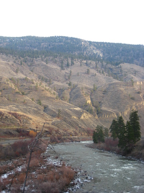
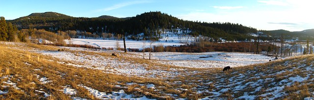
The swimming in the Sooke River is great, either right at the campground or downstream a bit at the official Potholes swimming area. There’s also a variety of hiking trails aside from the Goose itself, if you want to get your dayhike on.

Note that there is no cell reception at Potholes Campground itself, and very limited reception further south until you get a lot closer to Sooke Road. Whether this is a feature or a bug depends on you!

More of my photos from Potholes over at this Flickr album.

Categories
Local

Saanich Bike Festival

Starting to look at the several dozen photos I took at the Saanich Bike Festival back on April 19th. I’ve been given a Canon 50D DSLR by my father, who has upgraded himself to a very, very shiny 7D, so I took the new-to-me camera out to the Festival to fire off a few shots. I’ve never used RAW before, it’s been years since I handled an SLR, and I’ve never really used a DSLR, so the learning curve is fairly steep. It’s nice having a full-size camera again, though, and even though I’m still at the “no idea what I’m doing” stage the difference in photo quality is pretty obvious.

The Saanich Bike Festival itself was a lot of fun. The weather was gorgeous, I only dealt with a couple of dumb aggro drivers while I was being a volunteer road marshal (ie, human road barricade) during the bike parade up Shelbourne Street, there was a great turnout, and it was just nice to see so many people enjoying bikes!

Here’s a couple of photos; there’s a lot more waiting to be processed on my computer as I get to them and figure out RAW file processing. I still don’t have the colour and contrast quite right, and I’m honestly not sure if that’s because of the camera settings or the RAW processing settings I’m using. Further experimentation will have to take place.

I should also actually read the 50D’s manual sometime…

Saanich Bike Festival

Saanich Bike Festival Parking

Categories
Travel

Photos: Central France & the Loire

Still getting photos up onto my Flickr account, although over there I’m actually up to Nantes and nearly at the end of the trip, especially as I took very few photos in Paris right at the end of the trip.

Group Photo at the Loire

Above, group photo at Digion where we met the Loire, the last of this trip’s great rivers!

Modern Stain Glass

Stain glass in Nevers.

Gutter Runner

Gutter running in Nevers, two or three stories above the street.

Looking South from Sancerre

Looking south from Sancerre.

Another gym, Sully-sur-Loire

Our five-star accommodation in Sully-sur-Loire.

Sully Chateau, Straighter

We can’t stop now, we’re in chateau country! The first of the famous Loire chateaus in Sully-sur-Loire.

Bike & Loire

Our lunch stop somewhere along the Loire, near Orleans.

Me, Château de Chambord

Me, with the awesome Chateau de Chambord in the background.

Château de Chenonceau

Chateau de Chenonceau – the famous “bridge chateau” over the Cher river.

More to come, we had several more days in the Loire, then Nantes itself, a trip out to the Atlantic from Nantes, and then Paris!

Categories
Travel

Merritt & Salt Spring

Just before Christmas I got up to Merritt to see my father and stepmother, and took the camera along, naturally.

We took a walk along a section of the old Kettle Valley Railway right-of-way. I’d love to see this restored as a fully accessible multi-use trail and be able to do a multi-day bike camping trip along it. Maybe it’ll happen one day!

Vertigo?

Nicola River

We also went walking one afternoon in the ranch area up in the hills, and got some awesome winter sunlight.

Snow Pano

Trees

Closer to home, right at the end of January I got away overnight to Salt Spring Island to camp out at Ruckle Provincial Park. I went there in mid-October and decided to return again for another one-night escape.

Bike + Tent + View

Loaded for the Return

Ruckle is about 45-50km total road distance from downtown Victoria, with a 30 minute ferry ride over to Salt Spring Island from Swartz Bay giving a bit of a break.

Just a note if you do go out to Ruckle in winter, though, there’s no drinking water in the park from November 1st to March 1st — they disconnect the drinking water taps. Bring an extra water bottle or two.