The Velominati’s Rules are a mixed bag; most of them are either very silly, really only applicable to serious carbon-fibre roadie types, or both.
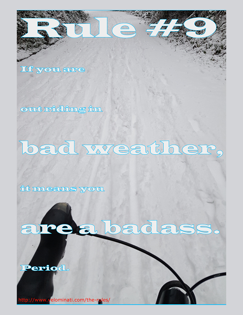
Some of them, however, really are universally applicable. Being a year-around bike commuter I’m especially fond of Rule #9, If you are out riding in bad weather, it means you are a badass. Period.
We’ve had an unusually snowy winter here in Victoria. I usually put the bike away during snow and let transit do the driving, but during our first snowfall before Christmas I was moved to try out snow-riding to get to work. It worked out OK, although my usual 15 minute commute took just over an hour in the snow!
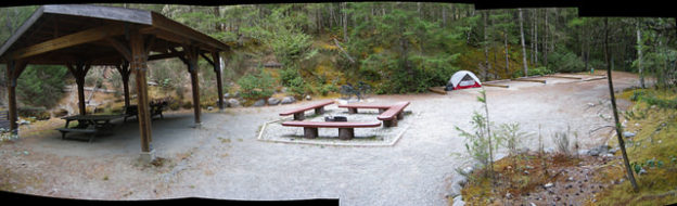
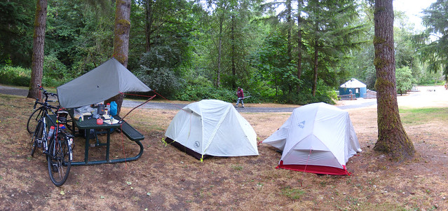
Hiker/biker group camp site at Sooke Potholes. Click to go to my Flickr collection of photos from there!
The CRD-owned, T’Souke (Sooke) First Nation-operatedSooke Potholes Campground is our new favourite bike camping site, especially because we’re lucky enough to live right next to the Galloping Goose Trail and can ride all the way out to Potholes without any navigation or traffic concerns at all!
Getting There
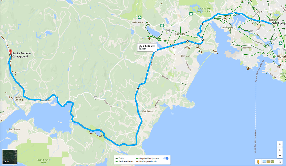
Switch Bridge Junction to Sooke Potholes Campground. Click for larger.
Potholes Campground is gloriously easy to get to – just get on the Galloping Goose or Lochside Trail and head west! No navigation concerns, no vehicle traffic except at road crossings. Kid and nervous cyclist friendly to a fault, barring the distance.
Note that Google Maps will try to route you through central Langford and onto Sooke Road (Hwy 14) by default. I do not recommend following these routing suggestions, unless you want to detour into Langford to get groceries, alcohol, or other last-minute shopping. Stay on the Goose trail the whole way for maximum ride comfort!
Speaking of shopping, Langford’s Westshore Town Centre mall is immediately off the Goose where the trail crosses Kelly Road/Veteran’s Memorial Parkway intersection; there’s groceries, a liquor store, coffee, bank machines, and a pharmacy all there if you realize you’ve forgotten something en route or need a refreshment break. There’s other options further out in Metchosin and Sooke, but Westshore Town Centre Mall is the last shopping centre directly off the trail.
The Goose is entirely gravel past Langford but generally in excellent shape, easy to ride on.
Camping There
The Campground proper is directly off the Galloping Goose Trail; there’s a short side trail (signposted) that drops directly into the top part of the campground from the trail.
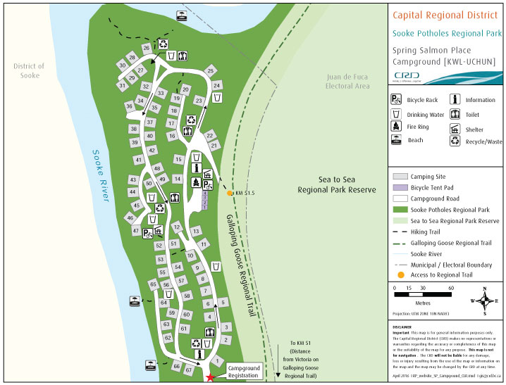
Sooke Potholes Campground (Spring Salmon Place Campground) campground map. The trail entry and group site are at image centre at the yellow dot. Map courtesy CRD.
Hiker and biker campers are welcome to use any of the regular campsites, but there is also the car-free group spot set up specifically for them! There’s a big picnic shelter, a shared fire ring, four large tent pads, and even a bike rack to lock your ride to! There’s a water tap, drop toilets, and garbage/recycling/compost bins just up the slope from the group site.
Hiker/biker group camp site at Sooke Potholes. Click to go to my Flickr collection of photos from there!
Note that unlike most other provincial or federal (National Park) campgrounds, the staff don’t come around to make sure camp fees are collected; if you come in the back way off the Galloping Goose you need to walk down to the gatehouse at some point and let them know you’re around and pay your fee. Fee is cash only — hope you remembered to hit that ATM in Langford!
Things To Do
The remains of Leechtown (a briefly-inhabited gold mining ghost town) are just up the Goose from the campground, on the other side of the river. I have to confess that I haven’t been over to Leechtown myself, not yet, but apparently there’s a few traces of roads and foundations to explore.
The Goose itself ends a few kilometres north of the campground at a very large gate blocking access to the CRD’s Sooke Water District lands. Some of us keep hoping the Goose will one day be extended all the way through the Water District lands to connect to Cowichan District trails up by Shawnigan Lake, but that isn’t going to happen anytime soon.
The swimming in the Sooke River is great, either right at the campground or downstream a bit at the official Potholes swimming area. There’s also a variety of hiking trails aside from the Goose itself, if you want to get your dayhike on.
Note that there is no cell reception at Potholes Campground itself, and very limited reception further south until you get a lot closer to Sooke Road. Whether this is a feature or a bug depends on you!
Haven’t updated since getting back from the trip; short version is that four days into the adventure, just outside Cle Elum, Washington, my brother broke his bike frame right at the rear axle mount and we aborted the trip, taking the Greyhound bus back to Seattle for a couple of days there before coming home via Vancouver a week early.
It was still a great bike tour while it lasted, and the Iron Horse State Park/John Wayne Pioneer Trail section up and over Snoqualmie Pass through the Cascades is an amazing trail, well worth the effort it takes to get a fully loaded touring bike up and over the gravel trail!
Quick late night post to say I’m off on another bike adventure! Not as epic as last year’s European trip but more adventurous than going out to Salt Spring Island yet again!
My brother and I leave Saturday the 25th of July for Portland, OR, taking a long route, up and over the Cascade Mountains via Snoquomish Pass, to Yakima, then down to the Columbia River and back to Portland via the Columbia Gorge. We’ll end the trip with an Amtrak train ride back to Vancouver, BC to get home.
Posts from the road as I have wifi or pay the extra for a day of data usage on the phone, but here’s some maps:
First Half – Victoria to Yakima – overnights on Whidbey Island, Tolt-McDonald Park near Carnation WA, Lake Easton State Park, Ellensburg, and Yakima.
Second Half – Yakima to Portland – overnights in Yakima, Brooks Memorial SP, then several days of wandering down the Columbia Gorge with lots of camping choices.
We’ll end in Portland sometime around the 5th of August, spend a couple of days there drinking beer, eating donuts, and poking around, before taking Amtrak’s Cascades run back up to Vancouver, BC to meet our respective girlfriends and end the whole trip there.